Barns of Mackinac County, Michigan
135 Barns plus a few "extras"
R.V. ("Dick") Dietrich
Professor emeritus C.M.U.
|
BARNS in Garfield Township THE
BARNS:
|
|
|
|
|
|
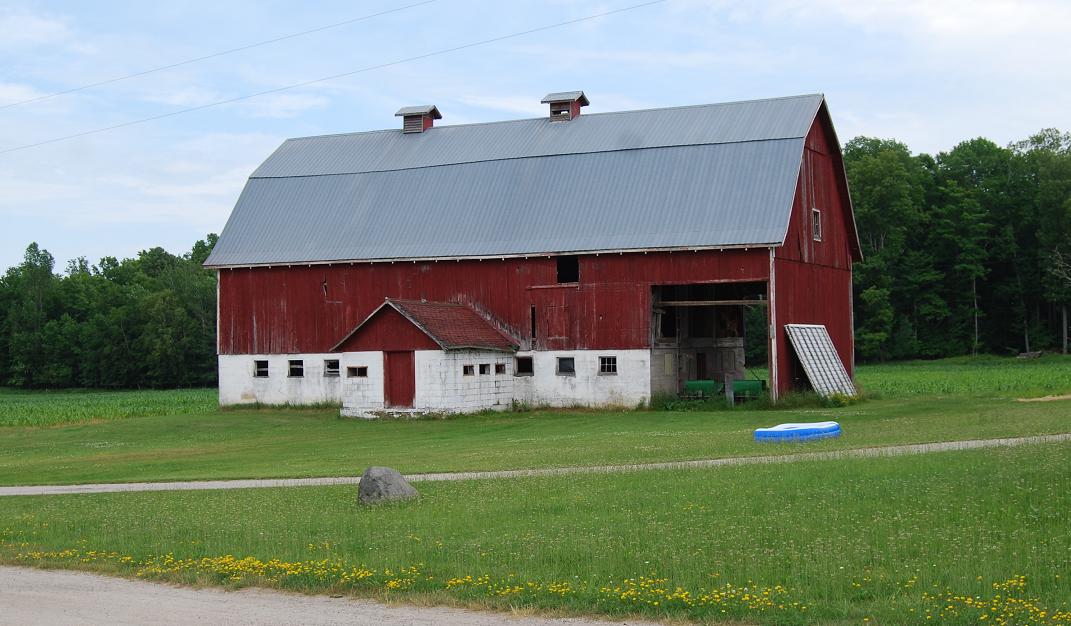
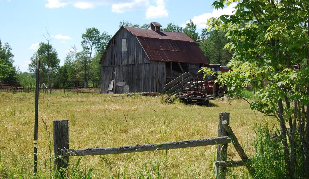
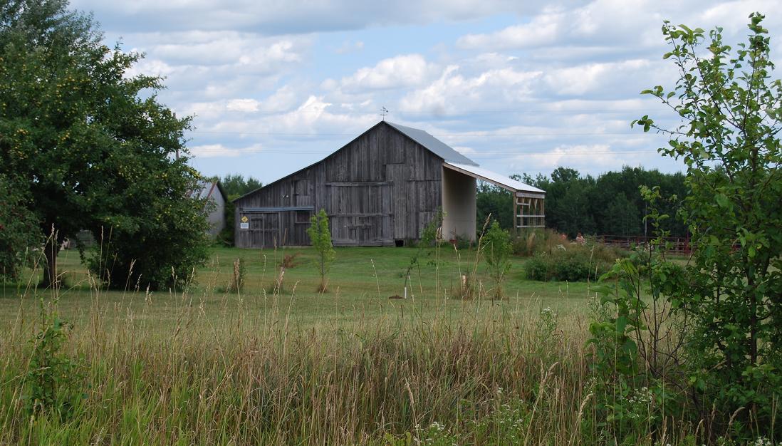
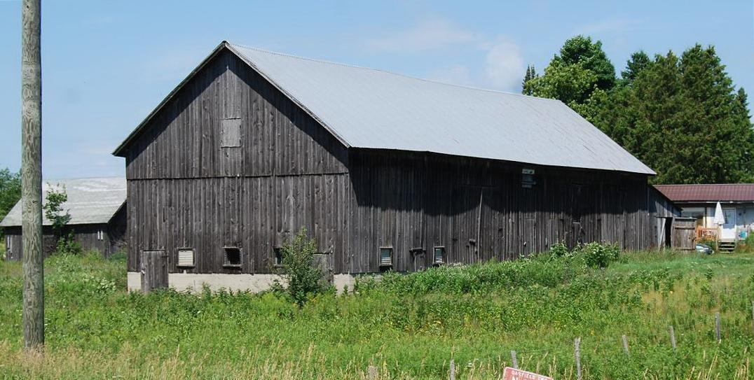
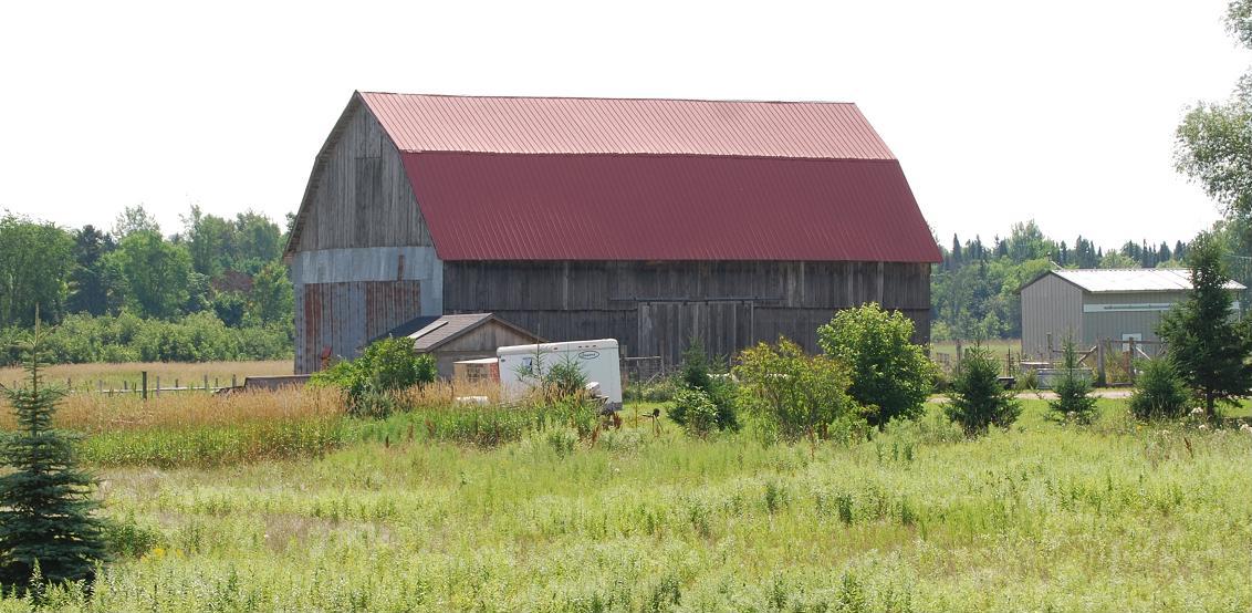
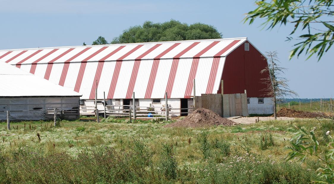
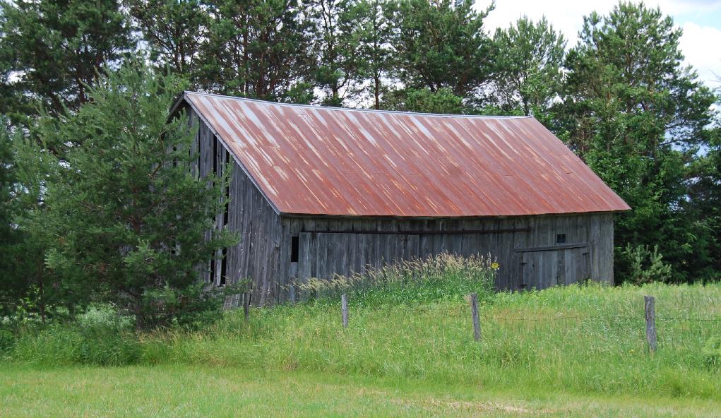
Ga1. (east of Rte. 117; SWĽ sec.16, T.44N.-R.10W.) Different, indeed conflicting, information has been given about this barn. Two versions are: 1. It was built by Bill Germain in 1947 for Herman Brockman, who used it as a dairy barn well into the 1970s. 2. It is replacement dairy barn that was built for Mervin Marcus soon after WW-II, perhaps in the early 1950s. This second version has the alluded-to preceding barn as having been built in the 1920s or 1930s for Adolph Marcus, Mervin's father. |
|
|
|
|
|
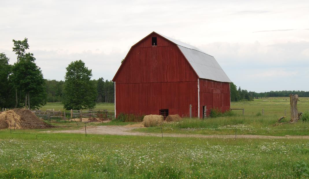
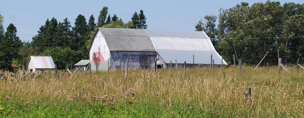
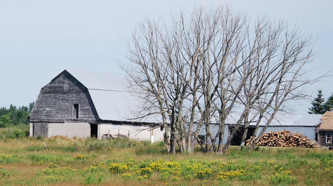
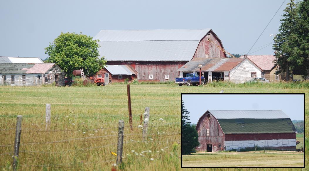
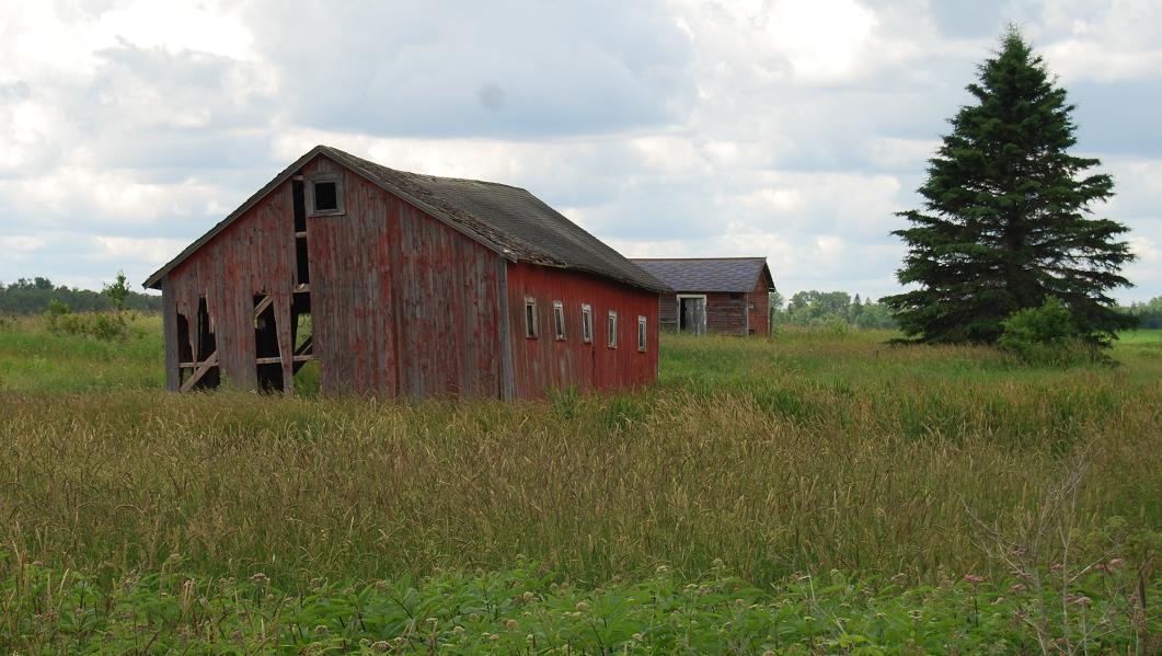
Ga2. (east of Rte. 117; NWĽ sec.16, T.44N.-R.10W.) This barn is thought to have been built in the 1940s for Earl and Esther Fergin. It is variously described as having been a dairy barn or used chiefly for horses. It also is said that in the past a much larger dairy barn was formerly behind (i.e., east of) this one. Notice that it is sided by clapboards. |
|
|
|
|
|
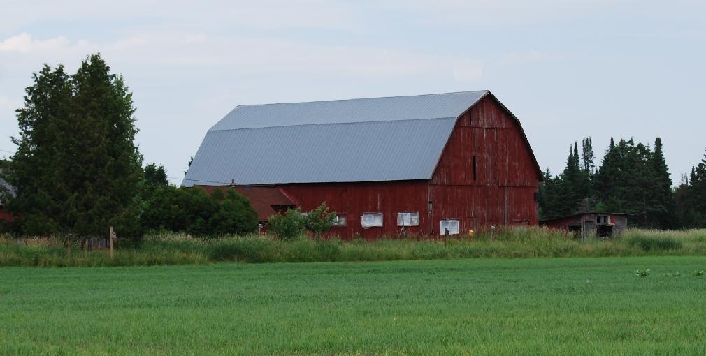
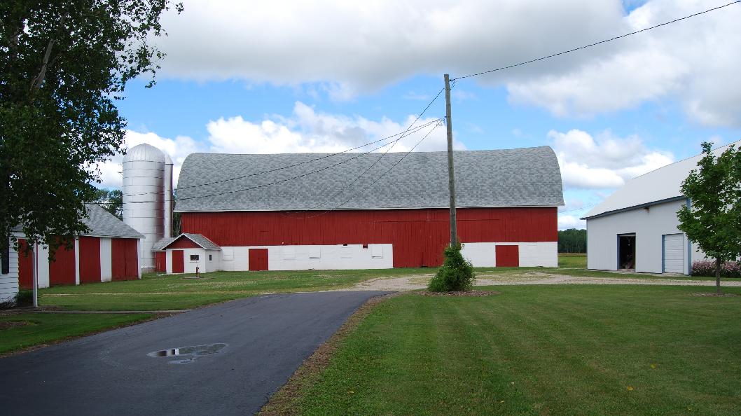
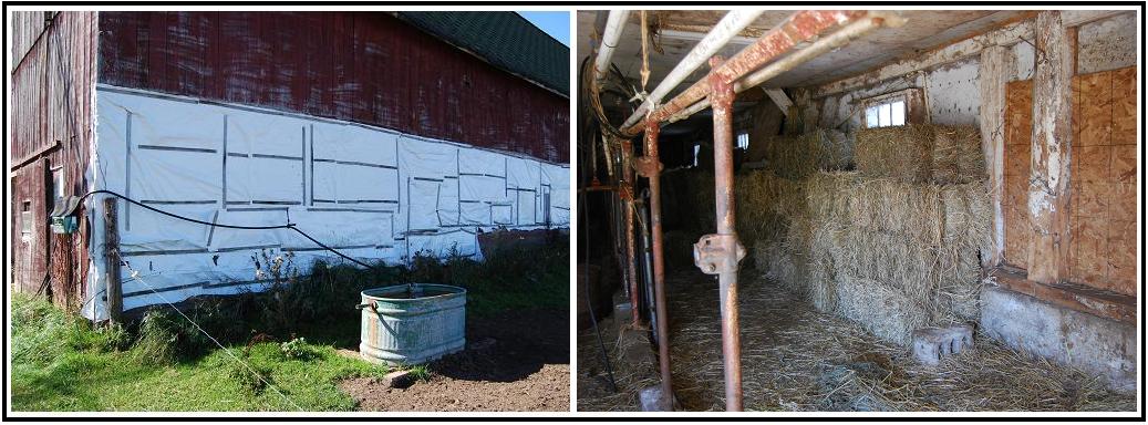
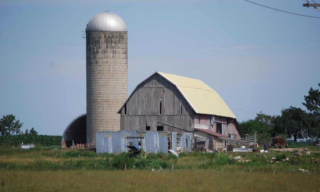
*Ga3. (west of Rte. 117; SEĽ sec.8, T.44N.-R.10W.) (#12, Brown Farm, in Engadine Museum display) This barn served as a dairy barn -- note the attached milk house -- from the mid-1950s until the early 1990s. According to the owners, Elmer and Ruth Brown, it was originally east of Pleasant Ave., in the NWĽ of sec. 29, T.44N.-R.10W., which is about 3 1/2 miles to the south-southwest of its present location. The move was in 1954. |
|
|
|
|
|
|
|
|
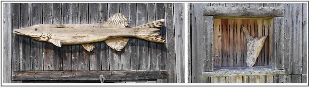
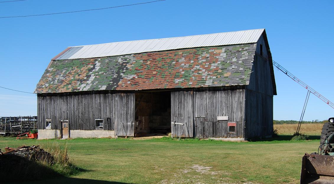
Ga4. (west of Price Rd.; NEĽ sec.30, T.43N.-R.10W.) This barn was built in the early 1930s. It replaced the original barn, which dated back to the late 1800s or early 1900s, that was on this farm. That barn was built for Ludwig Price; this one was built for Gus Bentz. The two decorative pieces shown in the composite were added in the 1990s: The fish was carved by Peter Dunham, nephew of the current owner, Chandler Hadley; the driftwood that resembles a steer's head in the "window," through which horse manure was "pitched" from the stable part of the barn, was collected and put there by Cameron Hadley, the current owner's son. |
|
|
|
|
|
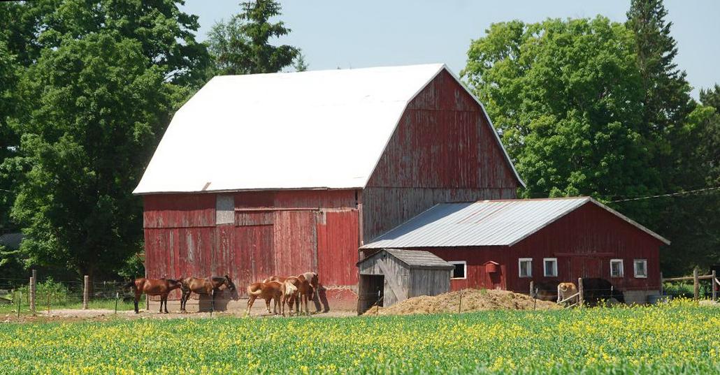
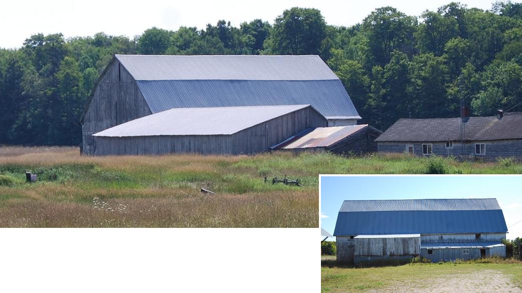
Ga5. (south of Linck Rd.; NEĽ sec.18, T.43N.-R.10W.) This barn, formerly a cattle barn, was built in 1940 for the father and son team, Anton and Frank Butkovich. It is on the east side of the unnamed road that extends southward from Linck Rd. to the eastern end of the western extension Stimich Rd. It is one of the few barns within the county with two cupolas, both of which are active ventilators. The small adjoined structure is the former milk house. |
|
|
|
|
|
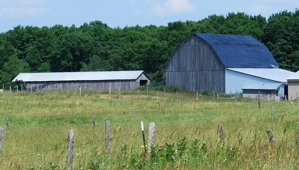
*Ga6. (south of Linck Rd.; NWĽ sec.18, T.43N.-R.10W.) (#9, Anton Butkovich Farm, in Engadine Museum display) This barn, that dates to 1936, was, like the preceding one, built for Anton and Frank Butkovich. It is on the west side of the unnamed road that extends southward from Linck Rd. to eastern end of the western extension Stimich Rd. Currently, it is being used chiefly to store hay; the lower level is, however, being left open for the steers in the adjoining corral. |
|
|
|
|
|
Ga7. (east of Pleasant Ave.; NWĽ sec.8, T.43N.-R.10W.) This barn, originally a dairy barn, dates to the early 1930s. It was built for Peter Eckenberg. |
|
|
|
|
|
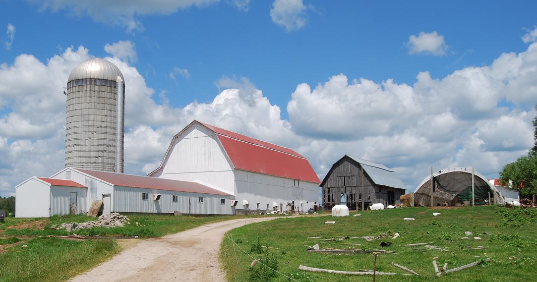
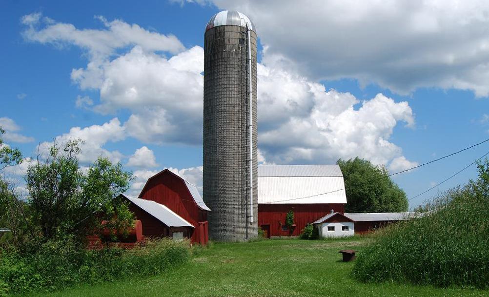
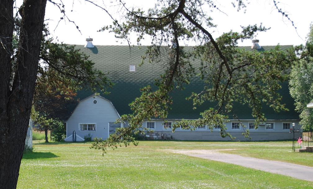
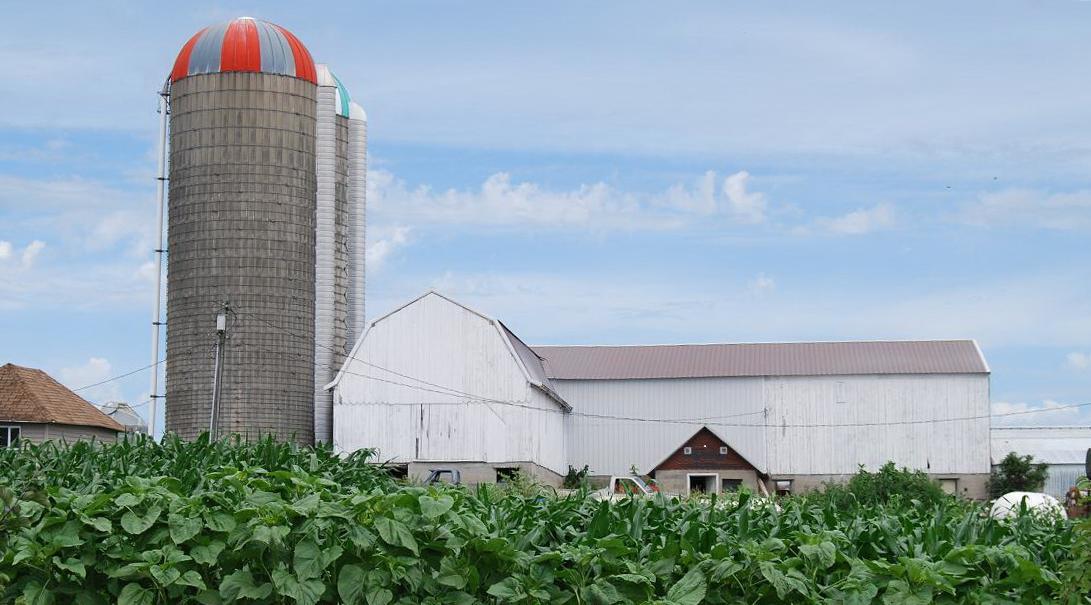
*Ga8. (west of Pleasant Ave.; NEĽ sec.7, T.43N.-R.10W.) (#1, Olson/Ault Farm, in Engadine Museum display) This large, round roofed barn was built in the early 1930s for Arthur Olson. The silo was added in 1952. The barn was used as a dairy barn until 1956, then to house beef cattle until 2005, and since then has seen little use. A photograph of Arthur Olson, taken in 1951, and an aerial photograph that shows this barn and nearby buildings are in Engadine...(1994, p.260). |
|
|
|
|
|
*Ga9. (east of Pleasant Ave.; SWĽ sec.5, T.43N.-R.10W.) (#10, Merrick Farm, in Engadine Museum display) This barn, which has a gambrel roof, was built for Christopher Merrick in 1916 or perhaps before then. The 1916 date is painted on the vent near its base; the attached ventilation system extends upward from the top of the milk parlor to the cupola at the crest of the roof. Much of the barn left of the cupola in the photograph was added to the original barn and thought to post-date the ventilation system. This is one of the barns in the county that has a "rain hood," widely called a "widow's peak" -- i.e., the place where one or more pulleys that served to lift the hay up from hay wagons to the haymow level were place and so-to-speak protected. |
|
|
|
|
|
Ga10. (west of Price Rd.; SEĽ sec.19, T.43N.-R.10W.) This barn, built in the 1920s, was moved from south of Rte. 2 to this locality in 1932. It was used chiefly to house horses. A nearby building of about the same size and with several characteristics similar to those of this barn was a granary. The barn is thought to have been built for Ferdinand Price, but possibly for his parents. They came to America from Germany when Ferdinand was 17-years old. |
|
|
|
|
|
Ga11. (north of Price Rd.; NWĽ sec.20, T.43N.-R.10W.) This barn is said to have been built in the late 1800s or early 1900s for the Rosenthal family. It housed a half dozen or so milch cows, and the "lean-to" portion is thought to have been where workhorses were kept. The high-level door opened into a haymow. The shingles, not shakes (to answer a question posed by a proof reader), are thought to be original. Similar shingles are beneath the more recently added metal roof. Today, this old barn is used chiefly for storage. |
|
|
|
|
|
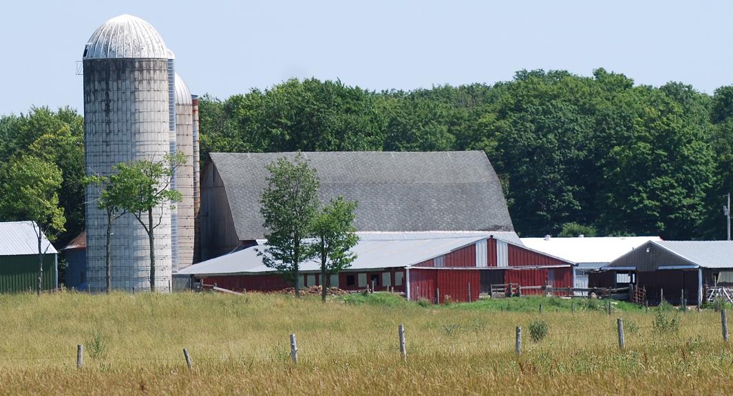
*Ga14. (north of Patzer Rd.; SWĽ sec.31, T.44N.-R.10W.) (#5. Patzer/Miller Farm, in Engadine Museum display) These two barns are treated as one entry -- the unpainted one, which is the older, is referred to as the north barn by the current owner, Wendell Miller. This north barn has 1917 noted in its eaves. The white-painted barn with the red roof has 1946 inscribed in its cement floor. Both of these barns were built for one of the early settlers in the area, Andrew Patzer, who owned the farm until the late 1960s. Both barns were originally dairy barns. Richard Miller, Wendell's father, who bought the farm in 1973, added the long, one-story addition to the white barn; cows were milked here until 1990 or 1991. Currently the white barn is used for young cattle and bedding. The silo was added in 1985. The semicircular roofed area on the right is where manure is stored until spread. |
|
|
|
|
|
Ga15. (east of Pleasant Ave.; SWĽ sec.32, T.44N.-R.10W.) This barn, which is known to have been built before 1915, was built for Karl Lenhardt, a German immigrant who homesteaded in this area. It is not known when the metal roof was added. |
|
|
|
|
|
Ga17. (east of Pleasant Ave.; NWĽ sec.32, T.44N.-R.10W.) This barn, which dates to the late 1940s, was built for Theodore and Violet Greenwald. The remains of the milk house in front of the main barn attests to the barn's former function -- i.e., to house a dairy, its hay, bedding, etc. The metal roof was added over the original shingles in the 1970s. Today, the barn is used for storage, including some hay. Two relatively modern metal silos are in front of the barn. |
|
|
|
|
|
Ga18. (north of Kovar Rd.; NWĽ sec.30, T.44N.-R.10W.) This dairy barn dates back to at least the 1920s. It was built for Ervin Kovar, son of Hynek Kovar, the first pastor of Bethelehem Luthern Church. |
|
|
|
|
|
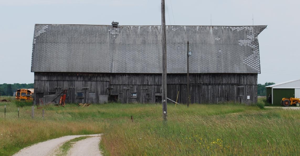
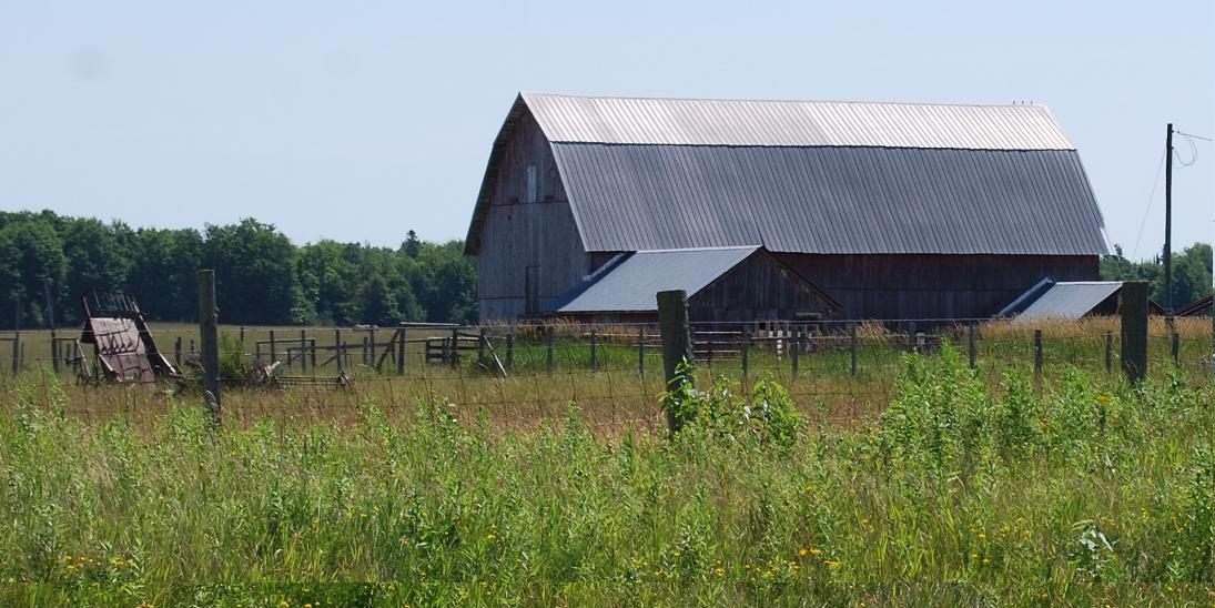
Ga19. (east of Krause Rd.; SWĽ sec.10, T.43N.-R.10W.) The larger barn, a dairy barn, was built for Harold Gage in the mid 1940s. |
|
|
|
|
|
Ga20. (south of Raski Rd.; NEĽ sec.9, T.43N.-R.10W.) Walter Price had this barn moved to this location in 1946. When the original barn was built is not known, and its former location seems to be known only as "from an abandoned farm on Rte. 117." Later, in the late 1960s or 1970s, the roof, especially of the eastern end, above right, was in need of repair. It was decided, however, to shorten the barn rather than to reroof all of it. More recently, the lower level adjoining part was added; the length of the lower add-on structure is thought to be approximately equal to the amount the original barn was shortened. |
|
|
|
|
| *Ga21.
(north of Raski Rd.; SWĽ
sec.3,
T.43N.-R.10W.) (#4, Krause Farm, in Engadine Museum display) This barn was built about 1916 for Adam Krause. |
|
|
|
|
|
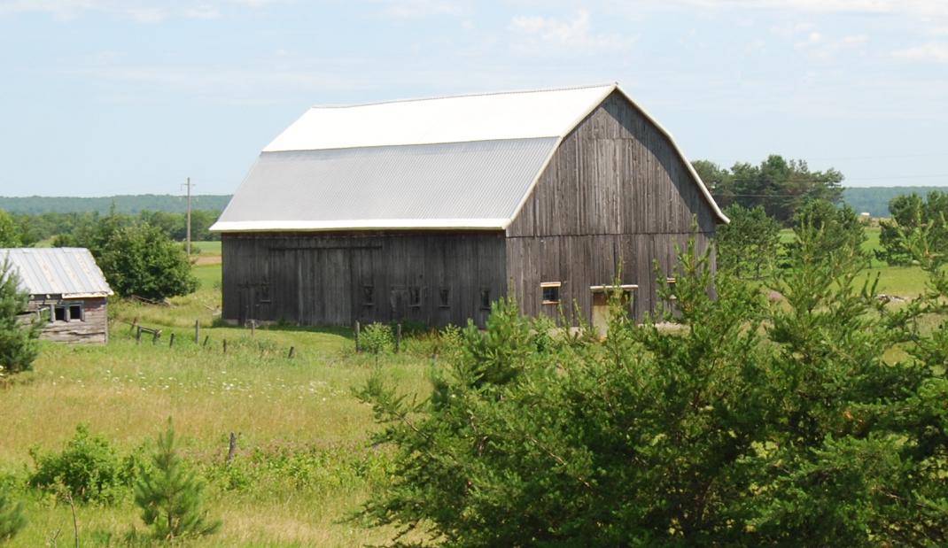
Ga22. (east of Indian Trl.; SWĽ sec.2, T.43N.-R.10W.) This barn is thought to have been built in the late 1800s or early 1900s by either William or Alex St. Dennis. |
|
|
|
|
|
Ga24. (north of Hiawatha Trl. [Rte. H40]; NEĽ sec.15, T.43N.-R.10W.) This barn was built by Bill Germain for Matt Klobucher, apparently of Croatian ancestry. The date is unknown, but it is known that the nearby farm house dates to 1927. In any case, the barn was originally, and for many years thereafter, a cattle barn. Notice in particular the cupola and the fact that some loose hay is still in the mow. |
|
|
|
|
|
Ga25. (west of Krause Rd.; NEĽ sec.4, T.43N.-R.10W.) These two end-to-end barns have rather different histories: The one on the right was built there and served as a dairy barn until 1993. It is still used to store hay. The one on the left was moved from about a quarter of a mile south to this site in 1975. The present owner believes that both were built before the 1920s. Notice that the larger barn, on the right, has a "widow's peak" at each end. It seems likely that these were originally made so hay could be unloaded from hay wagons at both ends of the barn. This would have facilitated moving the hay into the mow, especially considering the length of this barn; it may be that it was so-built so hay could be unloaded at both ends at the same time. In some areas, barns with "rain hoods" at each end are called "top hat barns." |
|
|
|
|
|
Ga26. (west of Krause Rd.; SEĽ sec.33, T.44N.-R.10W.) This barn was built by Adolph Flatt, a German immigrant, in the late 1920s or early 1930s. It was a dairy barn, with all the typical features such as its haymow, stanchions for the cows, and stalls for workhorses. |
|
|
|
|
|
Ga27. (west of Indian Trl.; NEĽ sec.10, T.43N.-R.10W.) This barn was built in 1946 for Frederick Pershinske. It was a dairy barn for many years. The small adjoining structure was the milk house. Currently the barn is used for hay and beef cattle. |
|
|
|
|
|
*Ga29. (west of Indian Trl.; SEĽ sec.10, T.43N.-R.10W.) (#7, Freeman/Nichols Farm, in Engadine Museum display) This barn was built in 1952 for Ed Nichols. This side area, with all the windows, was the milk parlor and at one end had pens for young stock and the resident bull. The smaller adjoining part, near the south (left in this view) of the barn with the gambrel roof was the milk house. A larger adjoining building, which was used as a feeder facility, is on the western side (other side) of the barn, where there also is a silo. The three cupolas are active ventilators. This barn was used as a dairy barn until the late 1960s. Since then, it has served may purposes. Examples are: It was at one time a rather elaborately furnished recreation facility for the children of Paul and Eileen Williams -- i.e., for the Nichols' grandchildren; it has been the scene of many square dances; it has served as the focus of family reunion for the last 25 years; and, of course, it is used for storage. |
|
|
NO PHOTO |
|
|
Ga30. (southeast of Raski Rd.; SEĽ sec.9, T.43N.-R.10W.) According to a man who, was in charge: ~"under no conditions can you photograph this barn, and no information will be given to you about it."~ |
|
|
|
|
|
Ga31. (south of Raski Rd.; SWĽ sec.9, T.43N.-R.10W.) This structure is said to be owned by same person(s) as Ga30. The photograph was taken from the road. |
|
|
|
|
|
Ga33. (east of Krause Rd.; NWĽ sec.27, T.44N.-R.10W.) This former dairy barn, also housed workhorses, hay, etc. The metal roof was added in the early 2000s on top of an asphalt roof that was put on top of the original wood shingle roof in the 1990s. The barn was built for William Schroeder by Bill Germain. |
|
|
|
|
|
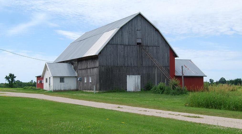
Ga34. (south of McKelvey Rd.; NWĽ sec.27, T.44N.-R.10W.) The grayed wood part of this former dairy barn was built for Fred and Amelia Marcus. It is thought to have been built in the 1920s or 1930s. During the late 1950s or early 1960s, it was jacked up and its current concrete foundation and floor were added. The red-painted additions were added in the early 1990s; the one to the south, left in the photograph, included additional stanchions to accommodate more dairy cattle. An old blacksmith shop and woodshed are also on this property. |
|
|
|
|
|
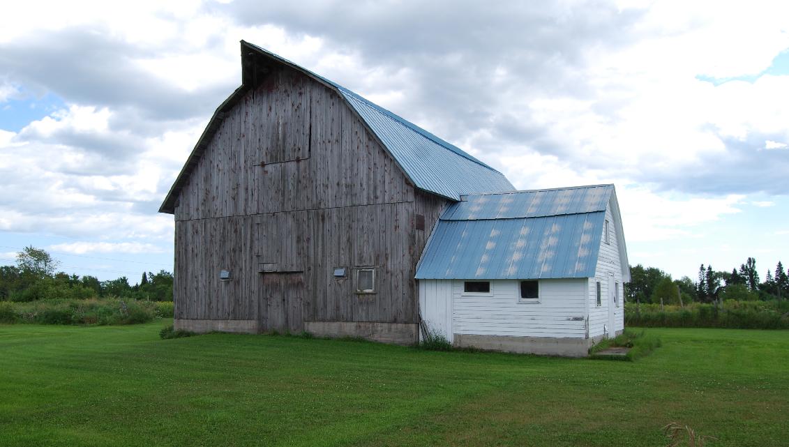
Ga35. (north of McKelvey Rd.; SWĽ sec.21, T.44N.-R.10W.) This L-shaped barn is thought to have been built in the late 1940s or early 1950s. Both sections are said to have originally had gambrel roofs. The gable roof now on one of the sections was added when its gambrel roof collapsed; with the advent of baled hay, the extra loft space was no longer needed. The barn as it now stands is said to date to the late 1980s. This is the main barn of the "Richlo Dairy Farms," which is one of the few within this township where milk continues to be produced. |
|
|
|
|
|
Ga36. (west of Krause Rd.; SWĽ sec.21, T.44N.-R.10W.) This barn, thought to date back to at least the 1920s, was owned by Adolph Hahn. The metal roof was added about 50 years ago. The smaller building in the foreground was the original house on this farm. In the 1930s, after the current residence was built, the large door and other changes were made to convert the older house so a tractor, among other things, could be put in it. A photograph that features this group of farm buildings is in the Engadine Centennial volume (1994, p. 124). |
|
|
|
|
|
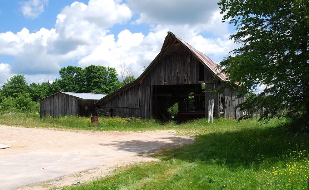
Ga37. (west of Krause Rd.; NWĽ sec.21, T.44N.-R.10W.) This barn is on the farm referred to by older residents in the area as the "old Wagner Place." The barn is known to have existed before 1947, and perhaps dates back to the late 1800s or early 1900s. If the earlier date is correct, it is thought to have been built for Martin and Augustina Marcus. the parents of Emma Wagner, who was Lewis Wagner's wife. Notice all the bales of hay, hay that is not in a barn, This serves as an example of hay storage that is no longer considered to require protection from the weather -- i.e., no longer even stored in a barn. And, hay bales that are covered with plastic are an even better example of this trend, which has led to the demise of many former farm barns. |
|
|
|
|
|
|
|
|
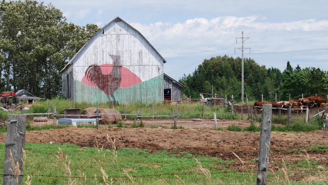
Ga38. (north of Sandtown Rd.; SWĽ sec.15, T.44N.-R.10W.) This former dairy barn is said to have been built in the 1940s for Joseph and Frieda Rapp. The rooster crowing as the sun rises painted on the south end of this barn was done by James Duberville in the early 1980s. The lower view shows the two kinds of roof now on the structure, which is now used mainly to store hay. |
|
|
|
|
|
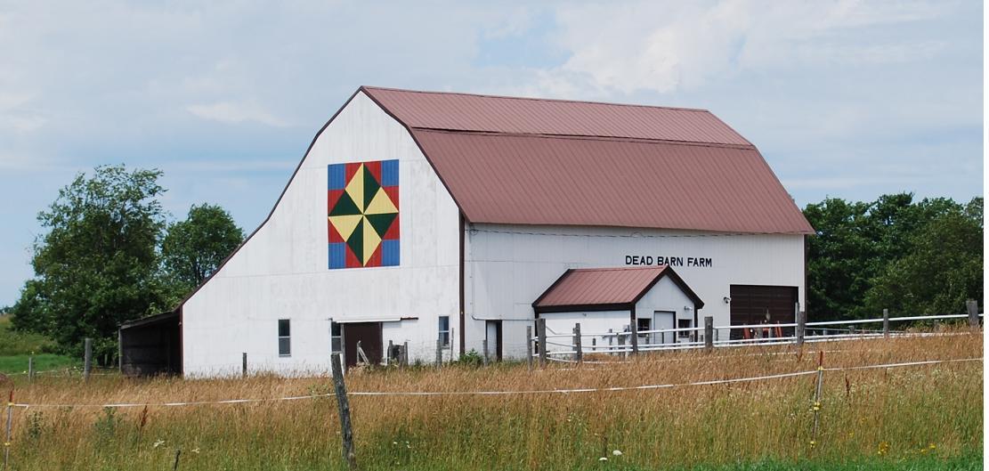
Ga39. (west of Krause Rd.; SEĽ sec.16, T.44N.-R.10W.) This barn, with the name "Dead Barn Farm" on its eastern side and the windmill quilt pattern painted on its southern exposure, was built for Ewald Fergin sometime before 1930. The current owners had the new roof and siding put on it in 1991-1992 and 2008, respectively. The quilt pattern was added in 2009. The name "Dead Barn ..." was given after a visitor, using a flintlock muzzleloader, accidently shot a hole through the barn, thus "killing it." However, the owner also noted that a nearby tractor was not hit and thus survived the incident. Originally and for several years a dairy barn, it is currently used for storage, as a tool shop and to house two riding horses and some beagle hounds. |
|
|
|
|
|
Ga40. (east of Krause Rd.; SWĽ sec.15, T.44N.-R.10W.) This barn, a typical cattle barn, was built in 1939 for Emil and Julia Feigel. The milk house was added later. The metal roof was added about five years ago. The green metal roof of the "widow's peak" is continuous with the main roof. |
|
|
|
|
|
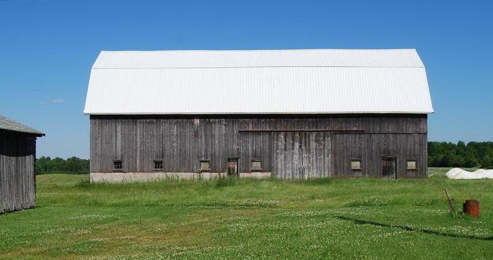
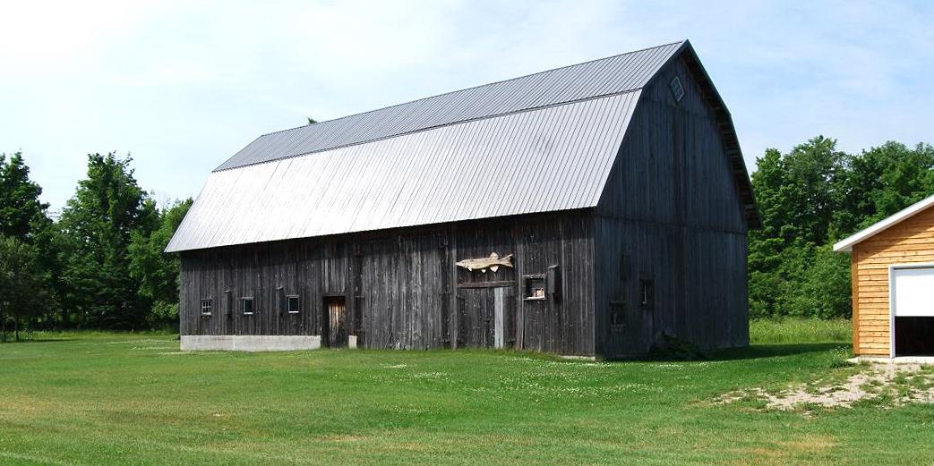
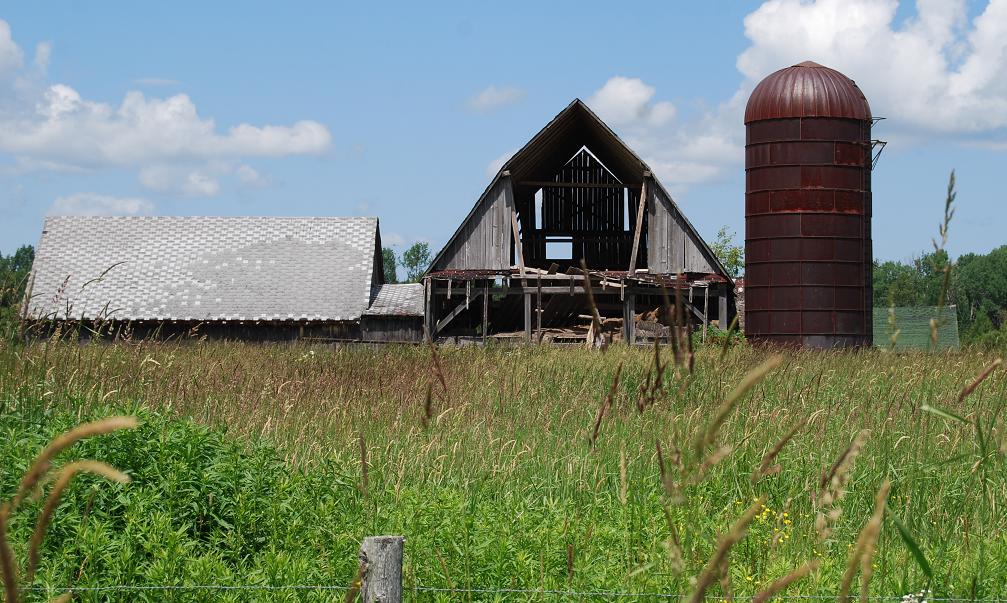
*Ga41. (east of Krause Rd.; NWĽ sec.15, T.44N.-R.10W.) (#15, Daniel & Philippine MacDonald Farm 1932-1970, in Engadine Museum display) This building is thought to have been a barn by some people and, as noted, is included in the Engadine Museum display of barns as #15; it is, however, questioned as ever having been a barn by some other people who are familiar with its use during the last 60 years. In any case, it is on the same farm as the building on the next entry (i.e., Ga42), and both of these buildings, along with the building, which was the old house, part of which is on the far left in the above view, are thought to have been built during the late 1800s or early 1900s. |
|
|
|
|
|
Ga42. (east of Krause Rd.; NWĽ sec.15, T.44N.-R.10W.) This former barn is believed to be have been built after the barn designated as Ga41. The roofed, open area is thought to have been used as a milking shed whenever the weather permitted such use. The new roof on the main part of this structure was added in 2009. Currently some riding horses are kept in this barn. |
|
|
|
|
|
Ga43. (west of Krause Rd.; NWĽ sec.16, T.44N.-R.10W.) This barn, said to date to at least the 1930s, was built by Martin Marcus. The interior of the barn has been markedly modified by the current owners. |
|
|
|
|
|
Ga44. (north of Brown Rd.; SEĽ sec.9, T.44N.-R.10W.) This barn was moved to this location, the farm of Clarence and Ida Brown, in 1947. It served as cattle barn for several years. |
|
|
|
|
|
Ga45. (east of Rte. 117.; NWĽ sec.21, T.44N.-R.10W.) No information has been found about this barn. |
|
|
|
|
|
Ga46. (west of Rte. 117.; NWĽ sec.20, T.44N.-R.10W.) This former dairy barn is referred to as the "Bentz' barn." It is thought to date back to at least the 1910s. |
|
|
|
|
|
*Ga47. (south of McKelvey Rd.; NWĽ sec.29, T.44N.-R.10W.) (#3, Adler/Edwards Farm, in Engadine Museum display) This barn was built in 1944 to replace an older one, which was built in the early 1900s for Sam Adler. After the older barn burned, this one was built on the foundation of the original barn. It was used as a dairy barn until 1999. |
|
|
|
|
|
Ga48. (south of McKelvey Rd.; NEĽ sec.29, T.44N.-R.10W.) This barn is thought to have been built in the late 1930s or early 1940s for Julius Fenske, whose log house is behind the Engadine Historical Museum. It was a typical dairy-hay barn. The adjoining building was a granary; the lower building, a chicken coop. |
|
|
|
|
|
Ga49. (west of Rte. 117; NEĽ sec.17, T.43N.-R.10W.) This barn dates to 1914 or 1915. Built for John Lesatz, it originally housed cattle and horses, their winter feed, etc. |
|
|
|
|
|
Ga50. (east of Rte. 117; SWĽ sec.4, T.43N.-R.10W.) This barn is thought to date back to at least the early 1920s and to have been built by Bill Germain's father, Gottlieb, for Fred Bessler. |
|
|
|
|
|
|
|
|
Ga51. (west of Rte. 117; SEĽ sec.5, T.43N.-R.10W.) The barn in the main photograph, with concrete blocks as it foundation and first level, replaced a former barn that was burned. The smaller building, which is shown in the lower photograph, is also said once to have functioned, at least in part, as a barn. It was built and originally used in the area to the south, across the present driveway; it has had additions attached to it since it was moved to its current location. Both structures are said to date to the 1950s or perhaps earlier. |
|
|
|
|
|
Ga52. (west of Rte. 117; NEĽ sec.5, T.43N.-R.10W.) This barn replaced an older one that burned in 1963 or 1964. It was built for Julius Zibart by Bill Germain and his crew. |
|
|
|
|
|
Ga53. (west of Rte. 117; NEĽ sec.5, T.43N.-R.10W.) This fairly recently built barn replaced an earlier one that had "Buss Dairy Farm" outlined in its shingles on the west, road-facing, lower section of its gambrel roof. The earlier barn burned in 1986. Both the former barn and this one (in an aerial view that includes the nearby farm buildings) are shown in the Engadine Centennial volume (1994, p. 85 & 87, respectively). |
|
|
|
|
|
|
|
|
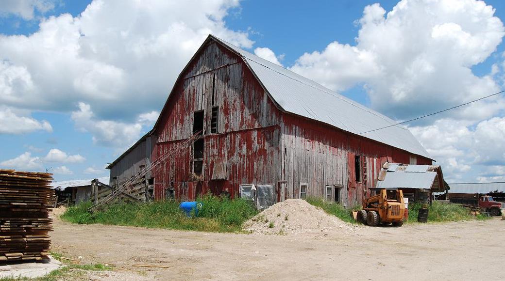
*Ga54. (west of Rte. 117; SEĽ sec.32, T.44N.-R.10W.) (#8, Strong/Germain Farm, in Engadine Museum display) This barn was built in 1945 on his own property by the area's well known barn builder, Bill Germain. As shown on the inset, the lower part of the gambrel roof on the north side still has the older asphalt shingle cover, which was apparently on all of the roof sections when the photograph in the Engadine Centennial volume (1994, p.124) was taken. It also seems notewothy that the lower part of the north side of this barn is covered with a sheet of insulation -- see the inset and the left photograph of the composite; in addition, a layer that consists of hay bales, three or four bales high, abuts this wall in front of the stanchions. These measures were taken when it was found that strong north and northwest winds were thought to be responsible for making the water in the cups on that side of the barn freeze. One particular thing that "caught my eye" while viewing these farm buildings was the bell atop the garage. Several of the farms in my native northern New York had similar bells that were rung as alarms to nearby farmers when the resident needed some help because of some emergency; few, if any, were rung, as some people in later years suggested, to get the fieldhands in for meals. |
|
|
|
|
|
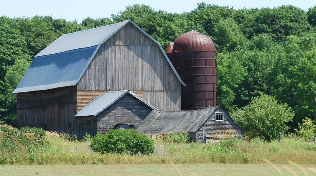
*Ga55. (west of Rte. 117; SEĽ sec.32, T.44N.-R.10W.) (#11, Stelter Farm, in Engadine Museum display) This barn was built for Julius Albert Edward Stetler in about 1928. It was a dairy farm for 50, perhaps more, years. The lower part of its gambrel roof with its so-to-speak plethora (?"crazy quilt"?) of colors gives it a character all its own. The remainder of the roof -- i.e., both the top sections and the backside -- are metal. |
|
|
|
|
|
Ga56. (west of Rte. 117; NEĽ sec.32, T.44N.-R.10W.) Little seems to be known about this barn other than the fact that it was probably built in the 1920s or 1930s. |
|
|
|
|
|
Ga57. (east of Rte. 117; NWĽ sec.4, T.44N.-R.10W.) This barn and the associated buildings other than the chicken coop have not been used for anything other than storage, and not even much for that, for several years. The chicken coop is actually being used as temporary residence . It is thought that Otto Schliske was an early owner, and perhaps the one for which the barn and probably most, if not all, of the other buildings were built. |
|
|
|
|
|
Ga58. (west of Rte. 117; NEĽ sec.8, T.43N.-R.10W.) This barn was built in 1944 by Bill Germain. It was known as the "Davis place." Early used as a cattle barn, subsequently it has been used to house young cattle and hay (chiefly bales), and currently is used as a storage facility. Unfortunately, this barn is obscured so far as getting a better photograph. The little windmill, by the way, is decorative. |
|
|
|
|
|
|
|
|
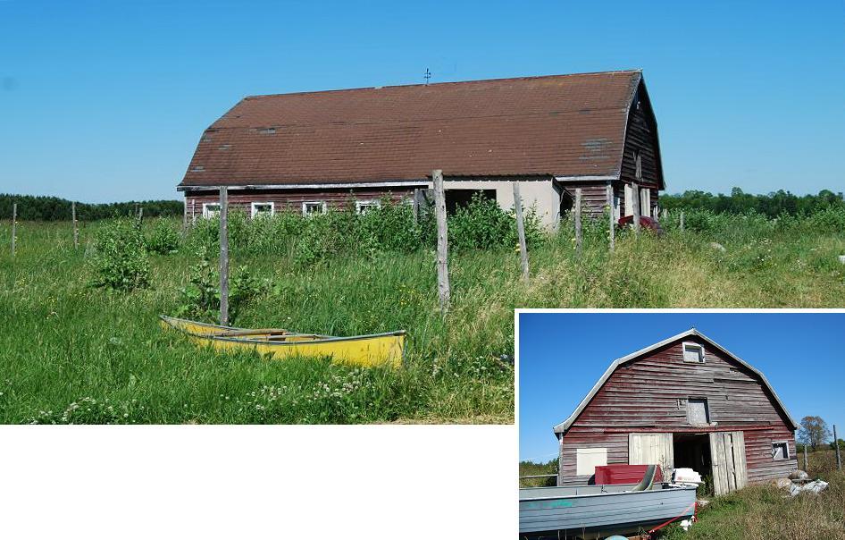
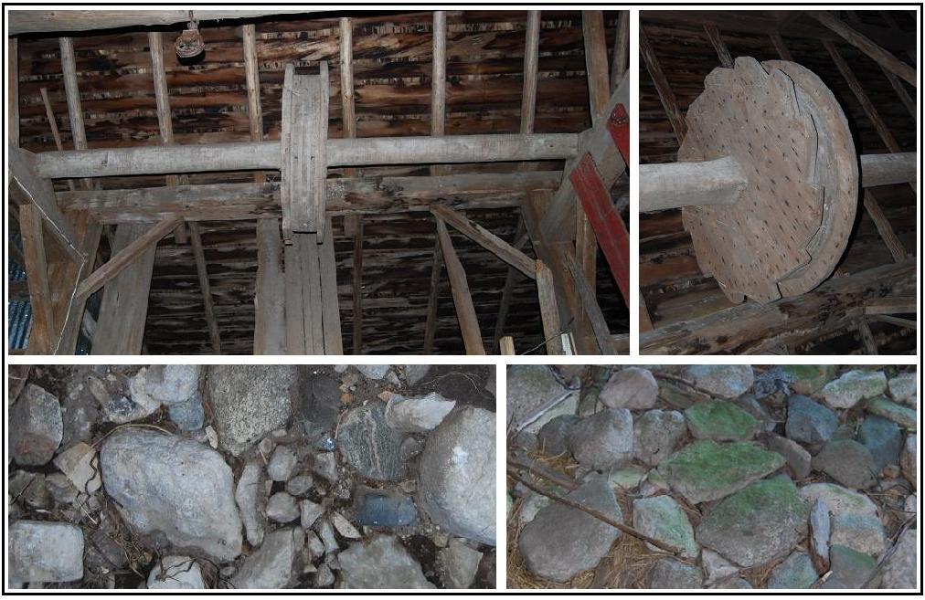
*Ga59. (west of Rte. 117; SWĽ sec.29, T.44N.-R.10W.) (#6, Poutie/Lehman/Shaum Farm, in Engadine Museum display) This barn was built for Charles Poutie, a homesteader, who registered the property in 1890. It is not known whether the barn was built before or after that. The original barn had large rocks for its foundation, with wooden beams, which extended between those rocks, serving as the bases for the bearing posts of the superstructure. Subsequently, some of the wooden beams deteriorated so, for example, the northwestern corner of the barn now has a concrete foundation. The current roof was added atop the original rafters and what was left of former roofing in the late 1960s. The corrugated metal, which was put over the original vertical wallboards, was added in the late 1970s. The composite: Upper- left, a windlass mechanism that consists of a central "reel," with a diameter of ~4˝ feet, mounted on a horizontal piece that extends across the open area, ~14 ft., between the eastern and western lofts of this barn near their southern ends -- i.e., farthest from the door where a hay wagon could enter the area; right, close-up that shows the notches that are on one of the outside rims, but not the other, of the "reel." Lower, two sections of the floor, which consist largely of cobbles and small boulders. Some of these rocks are glacially transported fieldstones; others are fragments of rubble derived from fairly nearby bedrock. |
|
|
[The windlass mechanism warrants further attention. The following conjectures and tentative hypothesis about it are based on cursory observations plus a few measurements. I have found no one who knew how it was actually used. This windlass was, I suspect, used, along with a rope or cable, either to hoist something up or to pull something COMMENTS FROM ANYONE WHO KNOWS ABOUT THE USE OF THIS APPARATUS WILL BE GREATLY APPRECIATED and added below. |
|
|
|
|
|
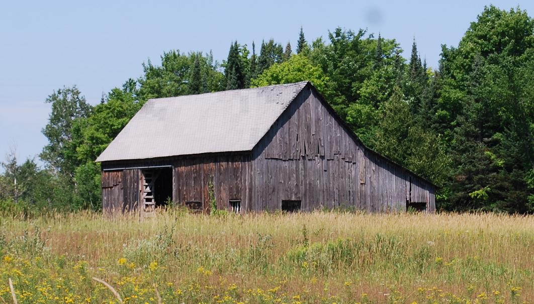
Ga60. (north of Hiawatha Trl.; NWĽ sec.15, T.43N.-R.10W.) This rather small barn-shaped building is referred to as an "old barn" by a man who grew up in the nearby area. He believes it was built by one of the Freemans, perhaps Jesse. |
|
|
|
|
|
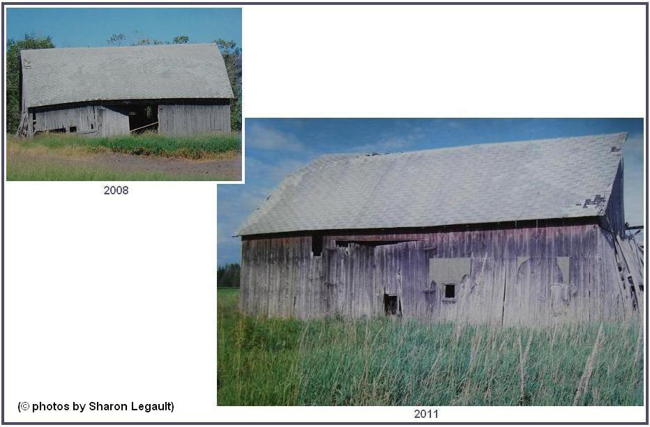
Ga61. (northeast of Warner Rd.; NEĽ sec.27, T.44N.-R.10W.) This old barn, the existence of which my attention was directed about the time the project was "winding down" to completion, is located in an area that is not easily accessible. Sharon Legault, the owner, kindly supplied the photographs of its two sides: the one on the upper left was taken in 2008; the one on the lower right, in 2011. The property on which the barn is has gone through several owners, and for which one(s) the barn was built is not known. Those owners included, from earliest to most recent, Philip and Amalia Meyer, Kenneth and Lorraine Leville, Dan and Viola Marcus and Carl and Sharon Legault.
|
|
|
|
|
|
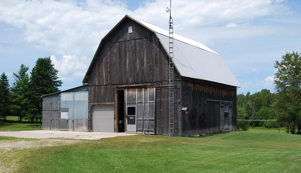
Ga12. (north of Linck Rd.; SEĽ sec.8, T.43N.-R.10W.) Extra no. 7: This barn was built in 1968 for John Ozanich. Its main purpose was to store hay, but beef cattle have been housed in it now and then. |
|
|
|
|
|
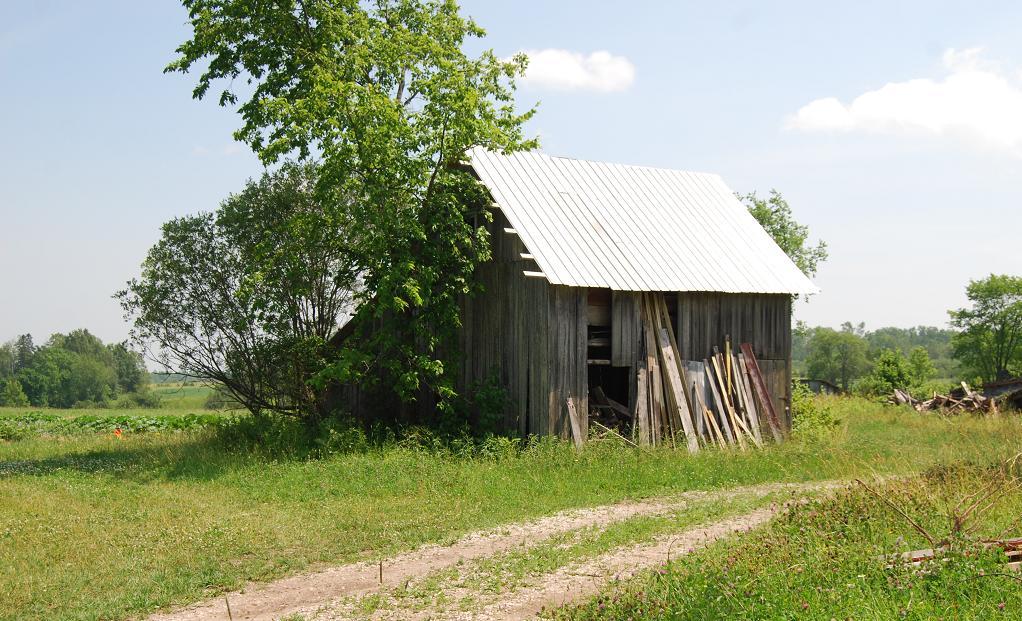
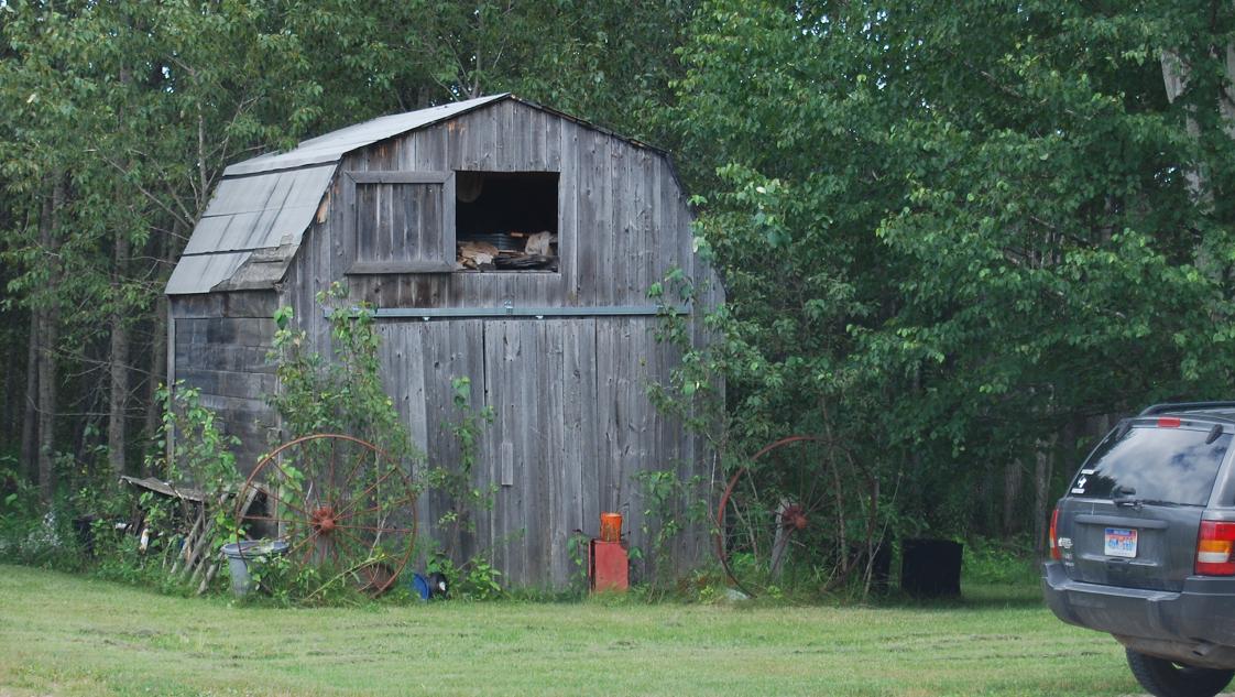
Ga13. (west of Pleasant Ave.; SEĽ sec.6, T.43N.-R.10W.) Extra no. 8: The owner of this building, which I originally thought might have once been used as a barn, told me it was a machine shed. |
|
|
|
|
|
Ga16. (west of Pleasant Ave.; NEĽ sec.31, T.44N.-R.10W.) Extra no. 9: This building, originally thought to have been a barn, was a granary and tool shed. It is known only to have been built "in 1940s or earlier," possibly for Walter Tomaszewski. The small building behind it in this view was a chicken coup built by Eddie Meyer in the early 1950s. |
|
|
|
|
|
Ga32. (west of Krause Rd.; NEĽ sec.33, T.44N.-R.10W.) Extra no. 10: This barn serves as an example of relatively recently built farm barns, of which there are a few within the county. |